The Enniskillen Backstreets-Dardanelles Memory Map was unveiled and demonstrated on November 26, 2022 at an event held at Fermanagh House, Enniskillen.
James Bamford of North Mapping Services demonstrated the final memory map which is available free to view on this website.
Other speakers were Frankie Roofe Fermanagh Genealogy Centre, Hazel Long Project Manager for LELP and Meave Cadden curator of Inniskillings Museum.
One year on and Fermanagh Genealogy Centre hosted an update on the Enniskillen Back Streets – Dardanelles Project at Fermanagh House on 15th October 2022.
James Bamford of North Mapping Services demonstrated how the final memory map would look and operate. Other speakers Frank McHugh, Frankie Roofe, Jim Quinn, David McNulty and Mervyn Hall spoke about the progress of their parts of the project.
Fermanagh Genealogy Centre launched its ‘Back Streets-Dardanelles project’ on Saturday 16th October 2021 at Fermanagh House, with a ‘Room and Zoom’ event. This community based project is dedicated to preserving the heritage of the old Back Streets of Enniskillen, demolished in 1970. The ‘Back Streets’ were also known as the ‘Dardanelles’ due to the high numbers of its young men who served and died in the Great War of 1914-1918.
Speakers at the launch outlined the key areas of the project which included:
The history of the ‘Streets’
The sacrifice of over sixty of its young men in the Great War
The employment and environment of this area
The social conditions of the ‘Streets’ and the community’s legacy.
To view the Launch Presentation, click here.
The project, which is a year-long event, intends to create an online memory map for posterity. The project is sponsored in partnership with the Lough Erne Landscape Partnership and the Heritage Lottery Fund.
We will be seeking help from anyone who has an interest in the old Back Streets and intend, as an integral part of the project, to interview those with links to the ‘Dardanelles’.
Anyone wishing to assist us can contact the project group at: fgcbackstreets@hotmail.com
We are pleased to have received the promise of photographs of some men from the Streets who perished in the Great War. However, we are extending the appeal for any memorabilia, be that recollections or tangible sources.
‘Bring and Tell’
FGC had a fabulous meeting on Saturday 27th November 2021 in Fermanagh House. Superb displays of First World War medals from Ollie Breen were on view and memorabilia from that era was set up by the Lisbellaw South Fermanagh World War One Society. This created a unique atmosphere.
A circle of chairs was occupied by the general public who were invited to tell their stories of the old streets – compered by Frankie Roofe. Tales of life in the streets were relayed and one sensed the very real community spirit that existed, and is now lost, from those hard times when neighbours helped neighbours. One contributor remembered how, during the good weather the doors of houses were left open and not locked at night.
Emotive tales of sacrifice during the First World War shone through, such as Kit Cleary’s chum, James Duffy (from Donegal) who won the Victoria Cross. Jim McClintock read a piece from a local newspaper that recounted the death of a family member, Sergeant William Hogan who was killed at the Somme. The account went on to say that 29 members of Hogan’s extended family served. Indeed, William Hogan’s brother, Michael was gassed and that same man had a son (Joseph) killed at the Somme.
Photographs and other memorabilia have since been made available to the project and this will help enrich our memory map.
Many thanks to those FGC members who helped to organise this event, its planning and the actual day’s activities. All this helped towards an unforgetting experience.

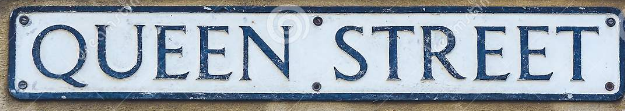

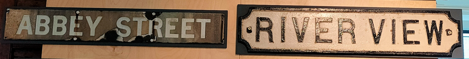

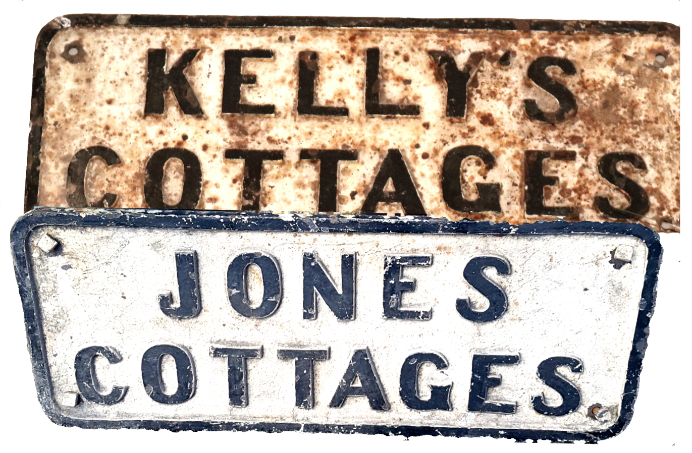
These Back Streets name plates were photographed by Jim Quinn.
1772 map of Enniskillen.
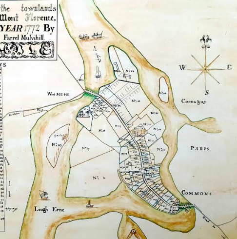
One can locate the ‘Royal’ or ‘Main’ Barracks at the very top of the map. Below the Royal Barracks, and to the east of Darling Street, and extending down to near the Church of Ireland, is the area which became the Back Streets. (One can make out St. Anne’s Parish Church which was renamed St. Macartin’s Cathedral.)
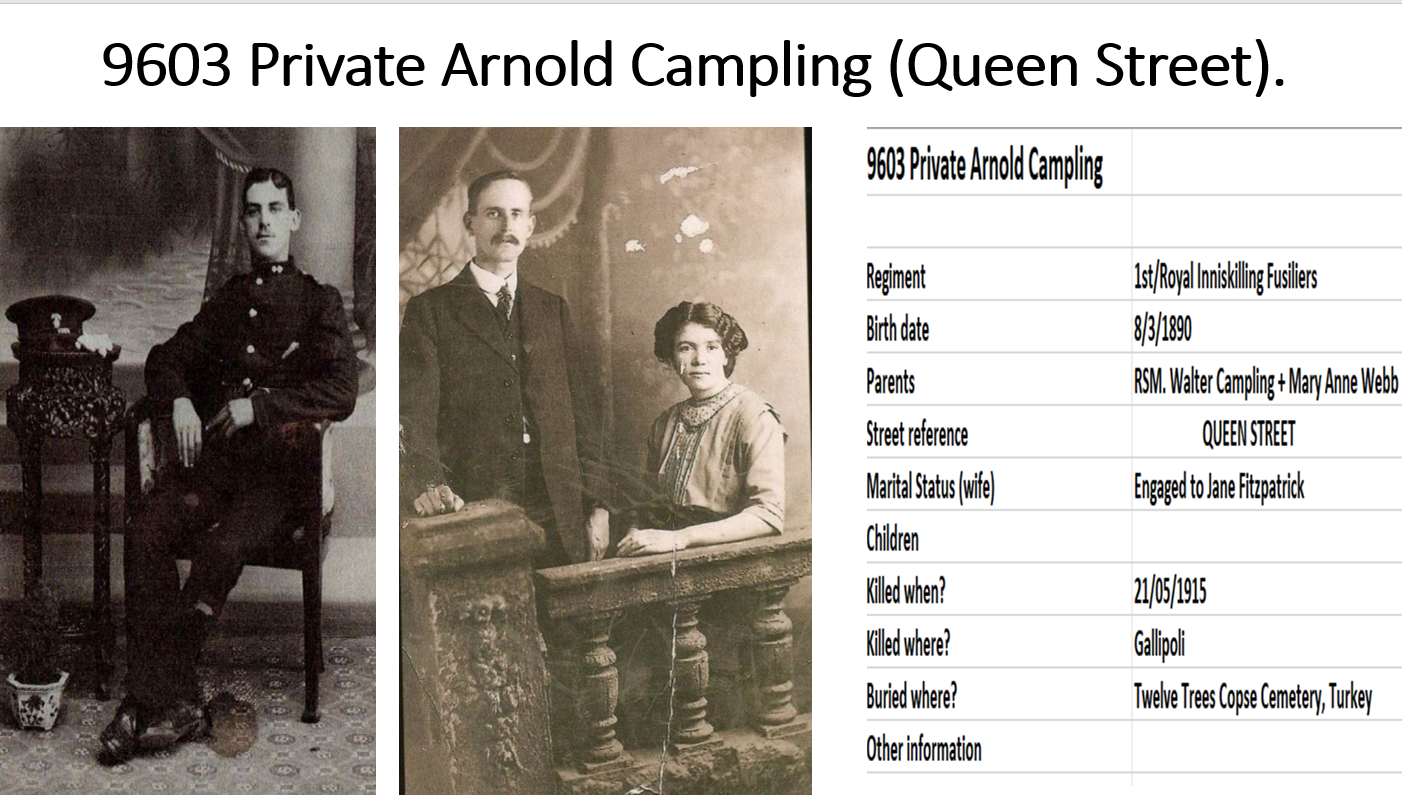
This is an example of preliminary research on one of the Dardanelles’ casualties.
We hope that you will join us on our journey over the oncoming year.
FGC Backstreets-Dardanelles group,